Ocean zoning for Tun Mustapha Park in Sabah
Background
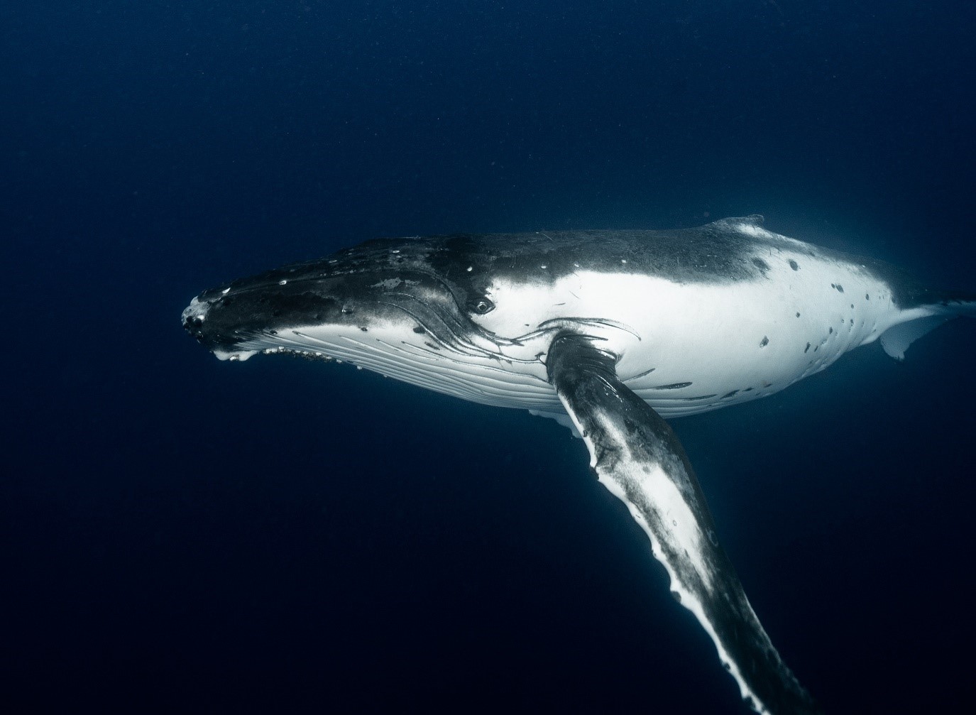
Tun Mustapha Park is located in the northern region of Sabah, Malaysia (Northern Borneo). The Park is globally significant for its marine life, with a rich diversity of coral reef, mangrove and seagrass habitats as well as several threatened species, including dugongs Dugong dugon, otters Lutra perspicillata, humpback whales Megaptera novaeangliae, and marine turtles (Chelonia mydas, Eretmochelys imbricata, Lepidochelys olivacea). The Park is home to > 187,000 people living in three administrative districts (Kudat, Pitas, Kota Marudu), almost half of which depend on marine resources for their livelihood and well-being. Fishing is a primary economic activity in the region. Although trawl and purse seine fisheries are the largest fisheries in the region, the live reef fish trade, long-line and small-scale artisanal fisheries are significant for local livelihoods. Habitats and marine life are thus threatened by a suite of human activities, including overfishing, destructive fishing, unsustainable coastal land uses, and illegal harvesting of marine turtles and eggs.
Zoning
Prior to this zoning effort two major marine zones existed within the proposed boundary of the Park: a commercial fishing zone and a traditional fishing zone. Both zones were insufficient to protect key habitats such as mangroves and coral reefs, existing laws were not fully enforced and as a result overfishing occurred and threatened species were killed. Potential new zone types were developed consultatively with key stakeholders from Sabah Parks, Department of Fisheries Sabah, Universiti Malaysia Sabah, Land & Survey Department, Sabah Forestry Department, and Persatuan Pemilik Kapal Nelayan Kudat (Kudat Fishing Boat Owners’ Association) and other NGOs. The new zone types determined for the Park were (1) a preservation zone, prohibiting all extractive activities; (2) a community use zone, in which non-destructive small-scale and traditional fishing activities are allowed and the nearby communities are encouraged to take part in the management of their own resources; (3) a multiple use zone, in which non-destructive and small-scale fishing activities as well as other sustainable development activities, such as tourism and recreation, are allowed; and (4) a commercial fishing zone, in which large-scale extractive fishing practices are allowed. Certain types of commercial fishing activities, such as long line (rawai) and recreational fishing, are also allowed in multiple use zones but not in the community use zone.
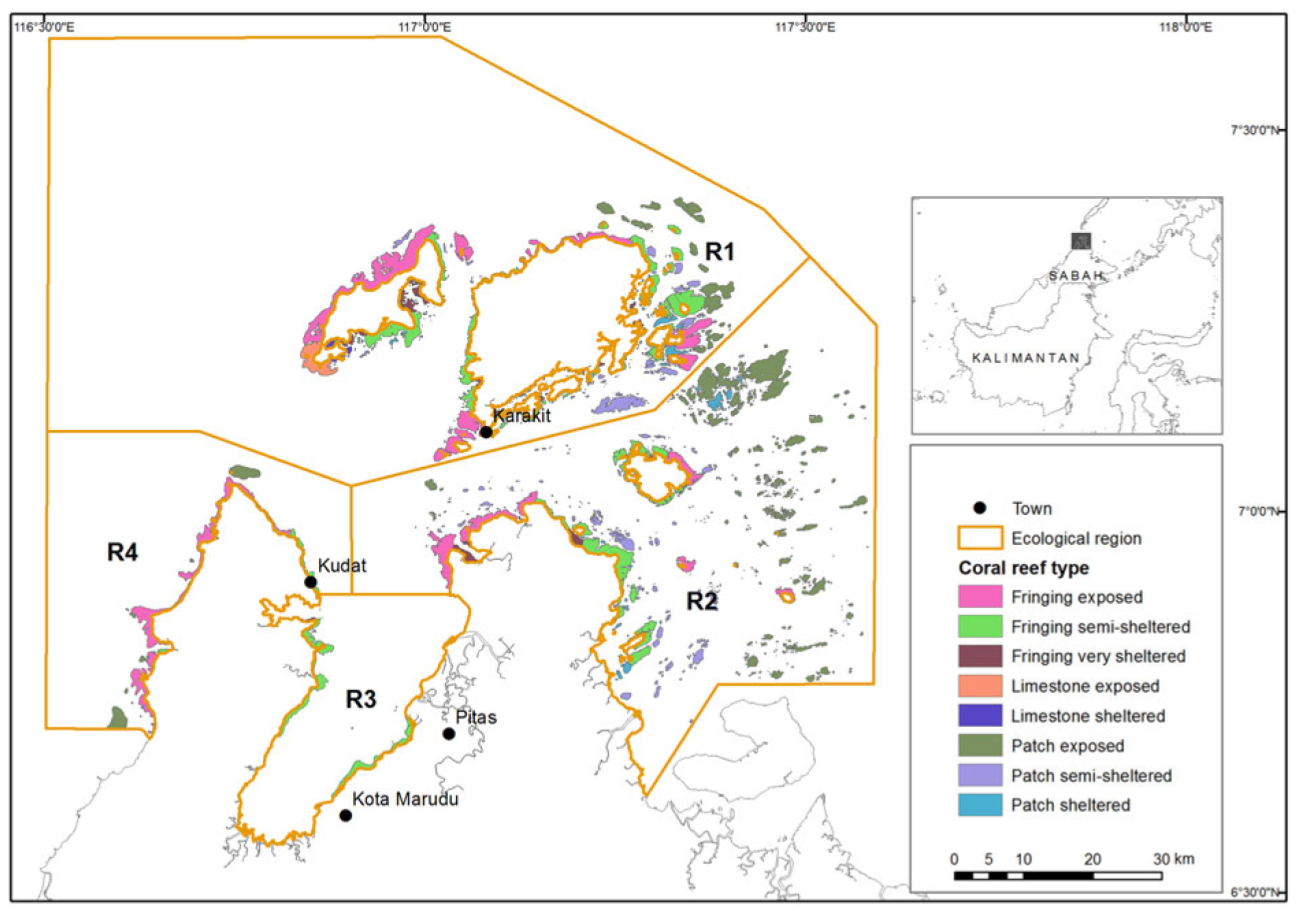 Coral reef types and ecological regions (R1–R1) within Tun Mustapha Park, Sabah, Malaysia
Planning process
Stakeholder outreach was focused on the three objectives to (1) eradicate poverty, (2) develop economic activities that are environmentally sustainable, and (3) conserve habitats and threatened species, with emphasis on how they could be achieved by a well-designed multiple-use marine protected area. Their involvement was crucial at all stages of the planning process.
Marxan with Zones was used in the creation of multiple use zoning plans to ensure a repeatable, transparent and scientifically credible methodology. Priority areas were identified for three zones: (1) preservation, (2) community use, and (3) multiple use. The commercial fishing zone was restricted to > 3 nautical miles from the mainland, which is the legal limit for commercial fishing activity in Sabah. However, this limit is not strictly enforced, and commercial fishing occurs closer to shore; a problem that will be addressed when the zoning plan is implemented. For each zone Marxan with Zones requires two types of information: (1) how much and what type of features (e.g. habitat, distribution, fishing grounds) should be included in each zone, and (2) the cost of implementing the zone. The best solution Marxan with Zones map was submitted to Sabah Parks to assess in terms of enforceability. Based on this map, Sabah Parks identified general areas for each zone, using the map as a guide to refine zone boundaries. This produced the first draft zoning plan that was endorsed by the Committee for stakeholder consultation. Additionally, facilitators with in-depth knowledge of the Park, its stakeholders and their languages conducted consultations for feedback on the draft zoning plan, targeting three main stakeholder groups: local coastal communities, the private sector, in particular commercial fishers, and government agencies.
Results
The zoning plan resulting from Stage 1 (Marxan with Zones prioritization) achieved all conservation targets. Stage 1 met the design principles for the preservation zones, representation of features and replication of features across regions. We found an even representation of features in the preservation zones, and an unequal representation of features in the other two zones. After consultation with Sabah Parks, they altered the zone boundaries. This process maintained the 30% habitat targets achieved for Region 1 and Region 2 but did not maintain the 30% targets for coral reefs and seagrass in Region 3 or for seagrass and turtle nesting in Region 4. The draft zoning map from this stage produced large coastal preservation zones, particularly around Banggi Island, driven by the desire to protect important coastal habitats such as seagrass and mangroves.
The stakeholder consultation process produced a result that reflects the general preference of stakeholders for more area assigned to community use and less for preservation. No 30% targets were achieved in Regions 1, 2 or 3. In these regions some features still achieved some inclusion in preservation areas (corals, dugong), but in Region 3 only 6% of corals were represented, and none of the estuary, mangrove or seagrass features. The 30% targets for coral reefs and turtle habitat were achieved for Region 4. Stakeholders' preference to have preservation zones located away from their villages contributed to the lack of coastal habitats in the preservation zone. In some cases, stakeholders recommended relocation of a preservation zone to areas that do not contain conservation features or important habitats. Some governmental decisions made during this process also contributed to the target shortfall, including excluding coastal land area and mangrove forest reserves from the Park boundary, and amending the outer boundary in some regions. This development equates to a change in management objectives during the process, where stakeholders decided that some nearshore habitats could not be represented, given their socio-economic and political needs.
Changing conservation objectives to accommodate economic and political realities is common but it compromises management outcomes and the livelihoods of people who depend on sustainable resource use. For example, many important fisheries species that are well protected on coral reefs require nursery habitat in seagrasses and mangroves, which remain unprotected. The biggest change was evident in Region 3. After the stakeholder process the coastal boundary of the Park was altered significantly; in some areas it was moved to 500 m away from the coastline, and the total area of the Park was reduced. Additionally, coastal habitats such as mangroves, seagrass and turtle nesting areas were excluded from the Park. As in Region 3, mangroves are not represented within the Park in Region 4, although some mangrove areas are protected by forestry management regulations. The establishment of Tun Mustapha Park as a multiple use park under IUCN Category VI (Protected Area with Sustainable Use of Natural Resources) is the first of its kind to be established in Malaysia, and the first under the Coral Triangle Initiative. The Park makes substantial progress towards the protection of biodiversity and the ecosystem services it provides to the local communities. The planning process began with the approval of the intention to gazette the Park by the Sabah State Government in 2003, and spanned more than a decade and included the establishment of a management plan and the design of the Park zoning plan.

References:
References
Jumin R, Binson A, McGowan J, Magupin S, Beger M, Brown CJ, Possingham HP, and Klein C. 2018 From Marxan to management: ocean zoning with stakeholders for Tun Mustapha Park in Sabah, Malaysia. Oryx. 52(4):775-86. https://doi.org/10.1017/S0030605316001514
Contact Information: