
Landscape-level mitigation in Mongolia
Background
The Mongolian Gobi Desert is part of the largest steppe ecosystem in the world that supports its historic wildlife assemblage, including long distance wildlife migrations, as well as traditional nomadic pastoralism. The region currently supports 34 animals listed as nationally threatened or endangered, including the world’s largest remaining populations of wild Bactrian camel, Gobi brown bear, Asiatic wild ass, Goitered gazelle, and Siberian ibex. However, the biodiversity and pastoral livelihoods of this area are threatened by rapid growth of mining and related infrastructure. In 1998, in anticipation of growth in the mining sector, the Mongolian government established a goal of designating 30% of the country’s land as national and local protected areas.
Today, the Mongolian government has developed a national, landscape-level, mitigation framework to designate new protected areas and guide biodiversity offset design based on systematic conservation planning. The planning process was completed between 2009 – 2017 through a collaboration between the Mongolian government, The Nature Conservancy, and a large community of stakeholders at national and local levels including government ministries and resource management agencies, academia, research institutions, and NGOs. The framework follows the Development by Design approach that integrates conservation and development planning by adapting conservation planning to effectively implement mitigation policy. This demonstrates that landscape-level mitigation based on stakeholder- and data-driven conservation planning is possible and practical.

Source: The Nature Conservancy
Planning Process
Following methods based on systematic conservation planning standards and adapted for landscape-level mitigation, using MARXAN, and guided by an expert advisory group, we identified a portfolio of sites that support native biodiversity and ecological processes representative of the Mongolian Gobi Desert, as follows.
Step 1. Site selection following portfolio design criteria. Using MARXAN, we identified a set of areas that, in combination with national protected areas, meets representation goals for biodiversity elements in a configuration with optimal ecological condition, efficiency, and connectivity (spatial contagion). We constructed a spatial analysis framework of hexagon planning units, 50 sq.km. each, to cover the 510,000 sq.km. study area. We locked in planning units containing existing priority conservation areas. Biodiversity elements were terrestrial ecosystems, defined and mapped with a biophysical classification and spatial model, with representation targets set as 30% of the area distribution of each ecosystem type, following the national protection goal. To maximize ecological condition, planning unit cost was derived from a spatial index of disturbance from cumulative anthropogenic impacts, so the more disturbed planning units had higher cost values. To maximize connectivity or spatial contagion, where possible, portfolio sites were selected as large, contiguous areas, using the boundary length modifier selected following a sensitivity analysis as recommended by Game and Grantham (2008). The initial site selection consisted of 50 sites covering 195,000 km2 or 37% of the study area.
Step 2. Re-design to minimize conflict with planned mineral development. The initial site selection included approximately 31,000 sq.km. (16% portfolio area) that were leased for mineral exploration. Recognizing that in the Mongolian Gobi Desert there are a range of options to meet representation goals and that many stakeholders did not want to retire existing exploration leases, we redesigned the initial portfolio to minimize conflict with exploration leases. Within the set of conflict areas, we identified cells with critical conservation significance based on three criteria – optimacity (Wilhere et al., 2008), rarity (is a modification of the Relative Biodiversity Index by Schill and Raber, 2009), and high quality habitat for endangered Mongolian khulan (Asiatic wild ass) – and designated these as areas where development should be avoided (19,850 km2 or 64% of the conflict areas). We replaced the remaining conflict areas (11,100 km2, or 36% of the conflict areas) with sites of similar composition and condition outside existing leases. The result is a redesigned portfolio that avoids mining leases except in areas of critical conservation significance, with no change in total area.
Step 3. Guide application of the mitigation hierarchy. The mitigation hierarchy – avoid, then minimize/restore, and finally offset, is a critical tool to manage development impacts, embedded in nearly every national mitigation policy and most lender and corporate policies, but it faces many problems in practice. In particular, avoidance, the most important step, is often skipped. Offset design also faces difficult questions about location relative to impacts, ecological equivalence of offsets to impacts, and uncertainty and conflicts with future development. The conservation portfolio and the supporting spatial datasets also provide a mechanism to address these challenges, first by directing avoidance to portfolio sites as new protected areas, and then by designing offset investments to support their restoration and management. This maximizes the regional conservation benefits in terms of ecosystem representation and improves long-term security of offset investments.
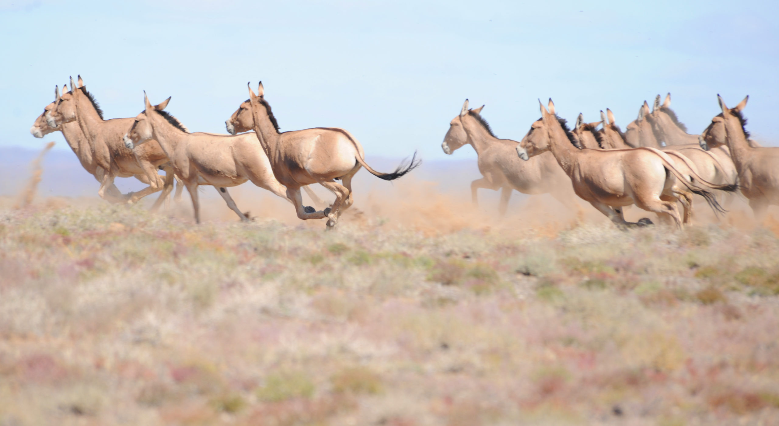
Khulan Running- The Nature Conservancy
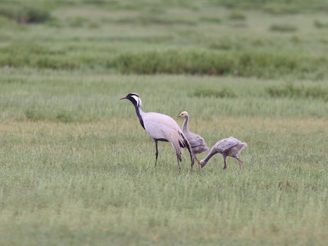
Demoiselle Crane with juveniles- The Nature Conservancy
Results
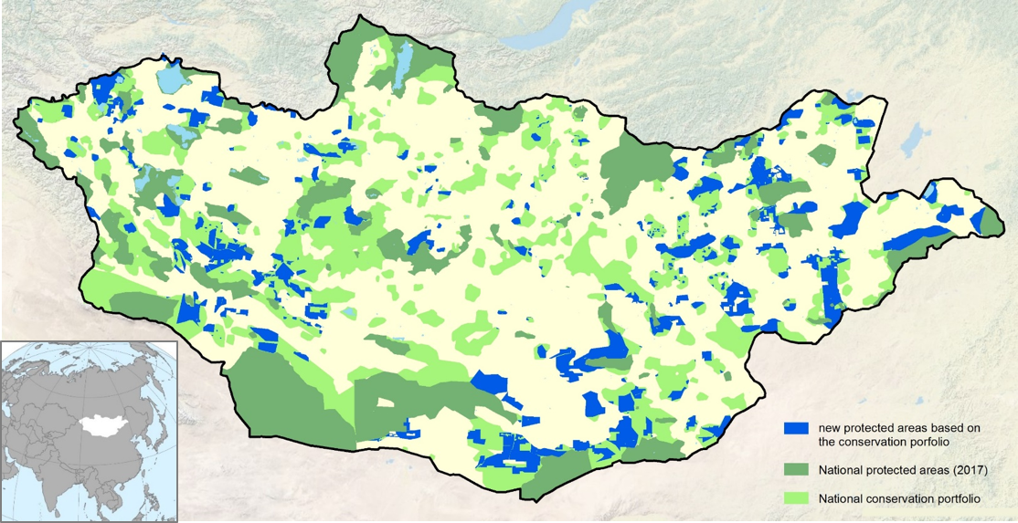
After completion of the Gobi Desert regional planning framework in 2013, 68,800 sq.km. of new protected areas were designated based on the portfolio and 160 exploration leases have been retired. The Gobi Desert planning process has been replicated across Mongolia and has directed designation of approximately 177,000 km2 of new national and local protected areas (see Figure). In 2012, the Mongolian Parliament amended the EIA law to require biodiversity offsets for all mining and oil development projects and require developers to calculate a minimum offset cost following specifications based on the conservation portfolio and supporting datasets. The specifications are designed to require higher compensation for impacts to rare and highly productive ecosystems, areas in good ecological condition, and/or near the portfolio sites, with the goal of steering development away from these areas. We attribute this success largely to stakeholder consultation throughout the planning process with a broadly defined set of stakeholders.
Contact Information:

Contact Information:

References:
Shifting Winds in the Mongolian Gobi Desert: Nature and Traditions Face the Modern Era (2019)


