Marine spatial planning in the Aegean Sea
Background
The European Union (EU) policies for the protection of the marine environment have been characterized as one of the most ambitious and challenging frameworks worldwide. The Biodiversity Strategy for 2030 requires member states to counteract biodiversity loss in Europe by protecting at least 30% of the sea and establishing a network of marine protected areas, of which at least one-third should be strictly protected. EU member states are required to implement marine spatial plans in their waters (Directive 2014/89/EU) to promote the sustainable use of marine resources. Sustainable development is a core concept in governmental and intergovernmental strategies such as Blue Growth, where Marine Spatial Planning (MSP) is considered an essential component to ensure the efficient and sustainable management of activities at sea. However, many scientists have expressed concerns about the imbalanced consideration of economic incentives over ocean health when such strategies are implemented. Decision makers and practitioners need rigorous methods and tools to apply MSP to ensure the sustainability of ocean-based economic activities and marine conservation. Systematic conservation planning (SCP) provides an ecosystem-based framework that identifies priority conservation areas, ensuring that actions are effective in addressing multiple threats while minimizing the costs of interventions. Thus, SCP can form the basis for the development of marine spatial plans focusing on biodiversity conservation.
Photo credit (left): Sylvaine Giakoumi
Study Region
The study area covers the Greek territorial waters within 6 nautical miles of the Greek baseline (coastline), or between the Greek coastline and the median line between the Greek and Turkish coastline, where the distance is less than 12 nautical miles between the coasts, and the international waters of the Aegean Sea. The total area covered is 213,168 km2. For the analysis, the study area was divided into 29,628 square planning units (PUs) of two different sizes: 2 km × 2 km for the Greek territorial waters and 10 km × 10 km for the international waters. Different PU sizes were used because species and habitats data in shallow waters were available at higher resolution, whereas in offshore areas data were obtained at coarser resolution.
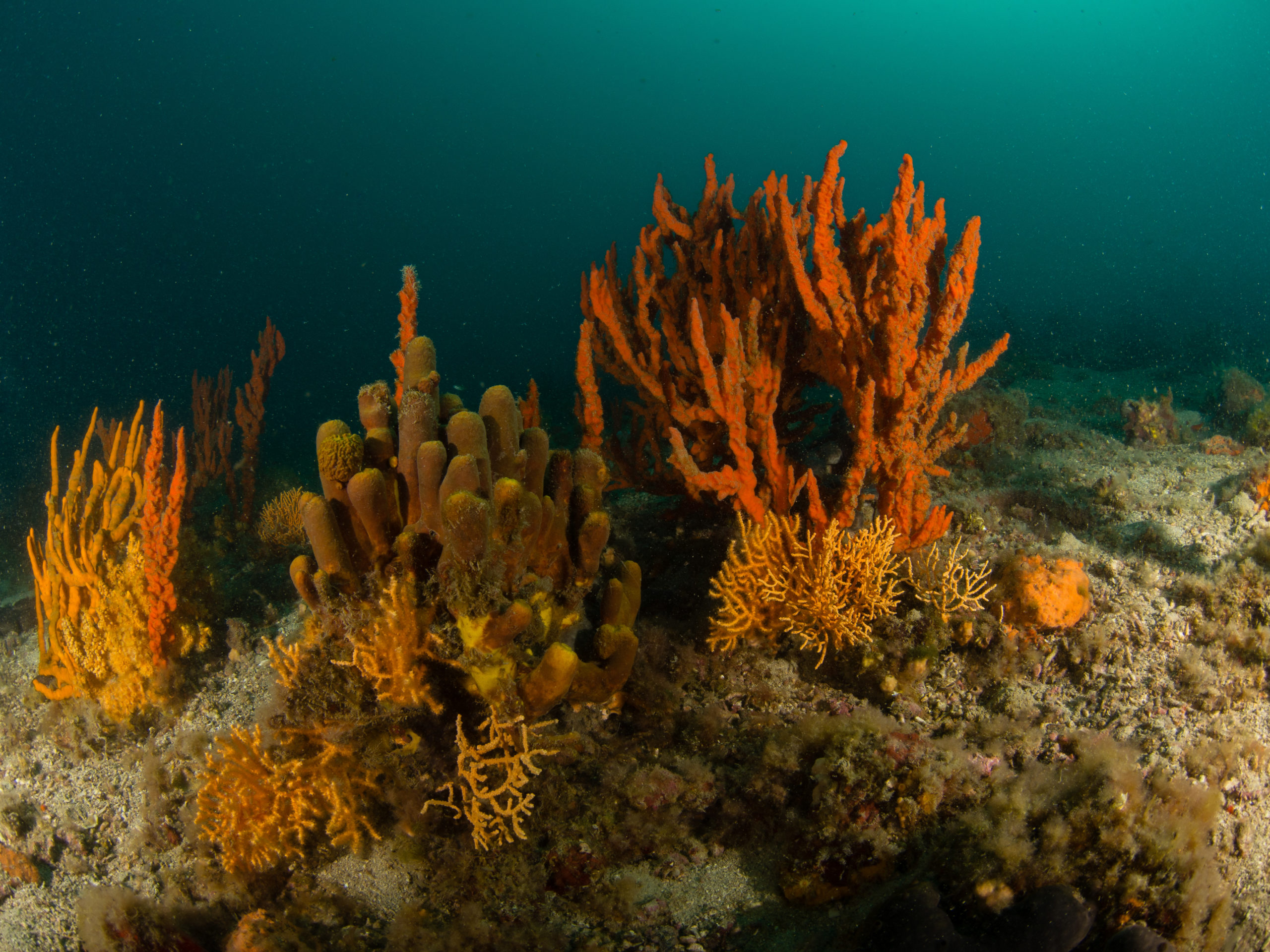
Photo credit: Thanos Dailianis
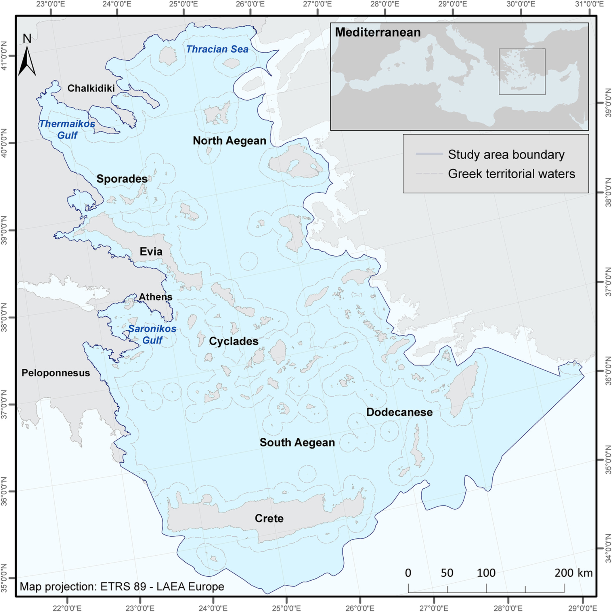
The study area of the Aegean Sea and Greek territorial waters
The zoning plan along with the general objectives and the activities allowed in each zone
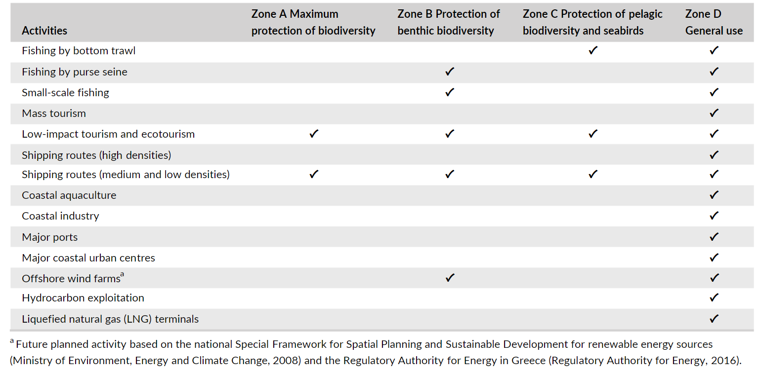
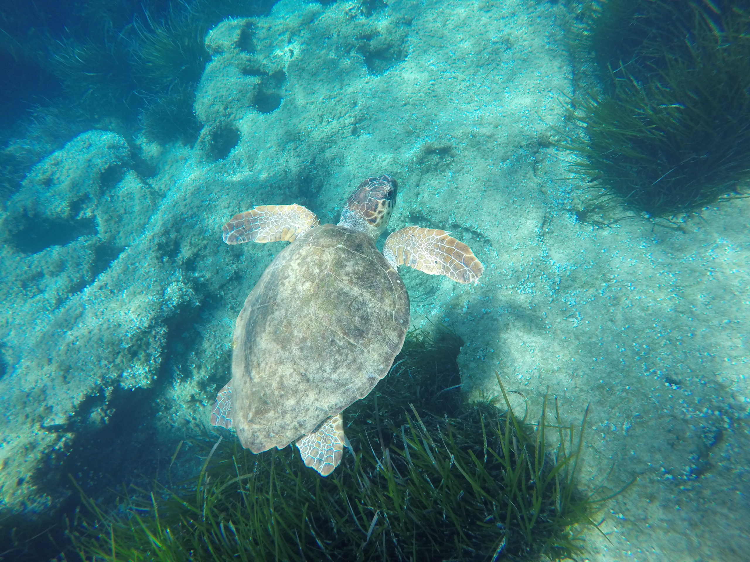
Photo credit: Stelios Katsanevakis
Scenario analysis
The expansion and intensification of marine uses have severe cumulative impacts on marine ecosystems and human well-being, unless they are properly managed with an ecosystem-based management approach. A systematic conservation planning approach, using Marxan with zones, was applied to generate alternative marine spatial plans for the Aegean Sea. Relevant human uses were included and their cumulative impact on a wide set of key biodiversity features was considered in the analysis. Different cost scenarios were developed to gain insight on the effects of the approaches used to assess socio-economic factors, and their potential impact on spatial plans. The vulnerability weights (the relative vulnerability of ecological features to specific human activities and their impacts) that were estimated based on a cumulative impact assessment, allowed the assessment of each zone in contributing to the achievement of conservation targets, through a transparent planning approach.
Results
The spatial plans generated differed greatly depending on the method used to estimate opportunity costs and evaluate human activities in monetary terms. Results indicate that special care should be given to how socio-economic activities, their impact on the ecosystems, and related costs are incorporated into planning. The proposed approach demonstrates how EU member states may effectively comply with the new Biodiversity Strategy 2030 targets, while planning for the sustainable use of their marine resources.
By implementing SCP to produce marine spatial plans for an area of global conservation concern, a broader example of how EU Member States can fulfil their commitments related to marine spatial planning, focusing on biodiversity conservation, is provided in the present study. As recommended by Katsanevakis et al. (2020), SCP can assist member states to apply MSP that meets conservation needs and secures the establishment of ecologically coherent networks of Marine Protected Areas across European seas, as requested by EU policies (e.g. the Habitats and Birds Directives, the Marine Strategy Framework Directive, and the 2030 EU Biodiversity Strategy). Although the recommendation of SCP as a means to achieve conservation objectives set by EU policies is not new, its implementation in practice lags behind.
References
Katsanevakis, S., Coll, M., Fraschetti, S., Giakoumi, S., Goldsborough, D., Mačić, V., Mackelworth, P., Rilov, G., Stelzenmüller, V., Albano, P.G., Bates, A.E., Bevilacqua, S., Gissi, E., Hermoso, V., Mazaris, A. D., Pita, C., Rossi, V., Teff-Seker, Y., Yates, K. (2020). Twelve recommendations for advancing marine conservation in European and contiguous seas. Frontiers in Marine Science, 7, 879.

Proposed management plans identified as the most efficient solutions that meet the targets for the species and habitats of conservation concern (‘best solutions’)

Irreplaceability analysis for the three protection zones, showing planning units (PUs) that have been selected more than 1,500 times (50%) out of the 3,000 marxan with zones runs in the three scenarios examined; zone A, maximum protection of biodiversity; zone B, partial protection of benthic biodiversity and seabirds; zone C, partial protection of pelagic biodiversity
References:
References
Vasiliki Markantonatou, Sylvaine Giakoumi, Nikoletta Koukourouvli, Irida Maina, Genoveva Gonzalez-Mirelis, Maria Sini, Kostas Maistrelis, Mavra Stithou, Eleni Gadolou, Dimitra Petza, Stefanos Kavadas, Vasiliki Vassilopoulou, Lene Buhl-Mortensen, Stelios Katsanevakis. Marine spatial plans focusing onbiodiversity conservation: The case of the Aegean Sea. AquaticConserv: Mar Freshw Ecosyst. 2021;1–15. https://doi.org/10.1002/aqc.3610
Contact Information:

Vasiliki Markantonatou
Department of Marine Sciences, University of the Aegean, Lesvos, Greece