
Designing MPA Networks in Indonesia
Background
Indonesia comprises some of the world’s most diverse tropical marine ecosystems that provide critically important resources for coastal communities. Many of these marine resources and their ecosystem services have been degraded or are threatened by a combination of local and global threats from fishing industries and other development. Marine Protected Areas (MPAs) are zoned areas with different management objectives that range from limiting human activity to full protection or “no-take areas” where removing anything from the MPA is prohibited. MPAs can serve as a powerful conservation management tool that addresses local threats while enhancing fisheries productivity, protecting biodiversity, and increasing climate change resilience. The national government of Indonesia is committed to establishing 30 million hectares of effectively managed MPAs by 2030. However, at present many of Indonesia’s MPAs are not yet managed effectively and lack the rigorous scientific and spatial design that would help them achieve this bold objective. To fill this gap, we gave technical support to Ministry of Marine Affairs and Fisheries (MMAF) of Indonesia to develop a MPA scientific framework that includes spatial design criteria, MPA performance indicators, and a training manual for MPA managers. This framework takes the unique biophysical, socioeconomic, and cultural characteristics of the country into account. We designed MPA networks at sub-national and provincial scales using the participatory expert mapping and the systematic conservation planning tool called Marxan. We have supported the design of a zoning plan for 14 individual MPAs spanning 2.04 million hectares in three provinces and identified national priorities for establishing new or expanded MPAs with total 5.3 million hectares in Eastern Indonesia. MPAs protect food security and livelihoods for communities and other stakeholders, so their spatial design is critical to meet multiple management objectives. This framework and analyses have led to the integration of MPA networks with Marine Spatial Plans that meet multiple management objectives including Fisheries Management Areas. Our approach facilitates the thoughtful creation of MPAs in Indonesia and the MPA manual provides practical guidance for managers as they protect and make critical decisions within the MPA and MPA network.
Healthy, high biodiversity coral reef in Misool MPA, Raja Ampat Islands. Image: © Awaludinnoer, TNC Indonesia Oceans Program.
Brief overview of methods
In partnership with the Ministry of Marine Affairs and Fisheries (MMAF) Indonesia; USAID Sustainable Ecosystems Advanced (USAID SEA), and Coral Triangle Center (CTC) we used a five step process to design a MPA network for Fisheries Management Area 715 (FMA715) and six associated provinces (West Papua, Maluku, North Maluku, North Sulawesi, Central Sulawesi and Gorontalo). We identified the goals and the design criteria required to achieve these goals, delineated the planning area and stratification units, identified the conservation features to protect, and threats and other uses to avoid, compiled and processed the spatial data layers needed to apply the design criteria, analyzed the data and designing an MPA network using the systematic conservation planning tool Marxan, reviewed the results at a scientific workshop, and manually refined the results. We used data from Badan Informasi Geospasial (BIG), MMAF, Participatory Mapping with Experts, Global Fishing Watch, Global Seafloor, and YKAN.
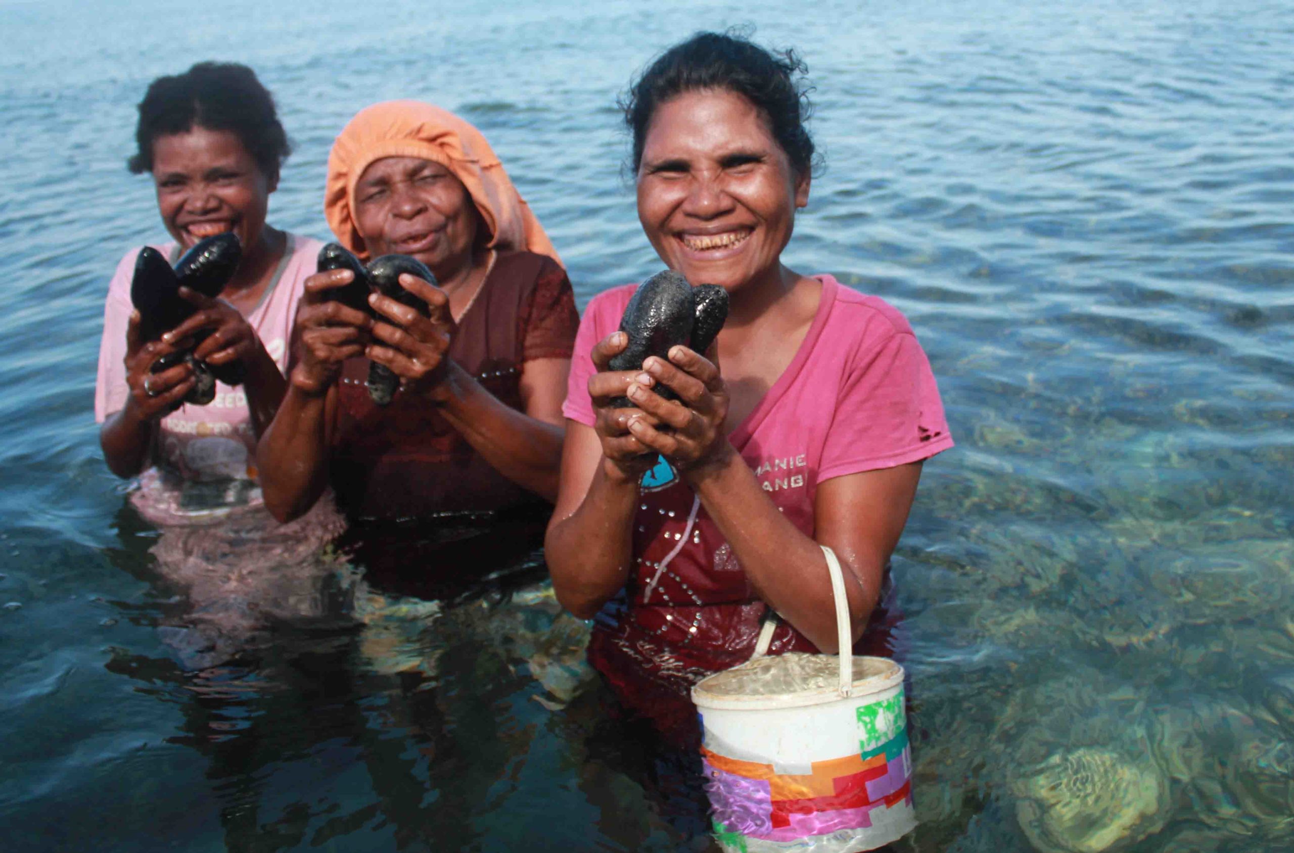 With advice from TNC, women in Kapatchol Village, West Misool (Raja Ampat) used traditional methods (sasi) to temporarily close a 100 hectare area to improve the harvest of sea cucumbers with scientific advice from The Nature Conservancy. Images © Nugroho Arif Prabowo, TNC Indonesia Oceans Program.
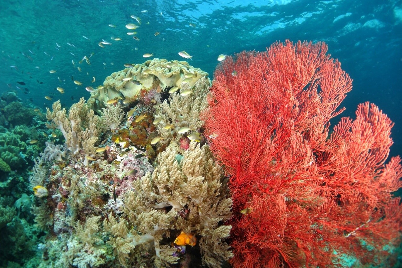
Healthy, high biodiversity coral reef in Misool MPA, Raja Ampat Islands. Image: © Awaludinnoer, TNC Indonesia Oceans Program.
Planning Area
The planning area spans 1,823 km from east to west (and 1,607 km from north to south), and encompasses an area of 1,613,457 km2 (161,345,748 hectares) which is 49.5% of Indonesia’s marine waters (3, 257, 483 km2: Table 5). The planning area includes both shallow (<200m) and deep water (>200m) areas, including a large proportion of the shallow water habitats in Indonesia (34.9% of coral reefs, 22.7% of mangroves, and 67.3% of seagrasses).
Stratification Units
We divided up the planning area into stratification units that represent the range of environmental, geographic and political (provinces) variation in the planning area. We stratified the planning area for the analysis in two ways: 1. By province, so the results can used to refine or develop MPA network designs for each of the six provinces that intersect with FMA715, and 2. By ecoregion to ensure that the design criteria of habitat representation and replication will be applied to each of the shallow water habitats (coral reefs, mangroves and seagrasses) that occur in each ecoregion.
Results
We conducted the Marxan analysis in two steps, because we had better quality data (higher resolution with more validation) for shallow water (<200 m) than deepwater (> 200m) habitats. First, we ran Marxan for the shallow water analysis only. Then we locked in the best solution from the shallow water analysis, and ran the shallow and deepwater analysis combined. This ensured that higher priority was given to using the better quality data in the analysis. It also prioritized protecting shallow water habitats and critical, special and unique areas, while considering connectivity between shallow and deepwater habitats. To do this, we used different data layers and planning units for each analysis. For the shallow water analysis, we used: data layers for MPA status (existing and proposed MPAs in Marine Spatial Plans), conservation features (shallow water habitats and critical, special and unique areas), and other uses; and smaller planning units for a finer scale analysis. For the combined shallow and deepwater analysis, we used: data layers for the result (best solution) from the shallow water analysis, conservation features (deepwater habitats) and other uses, and larger planning units for a coarser scale analysis.
We explored several scenarios that used different data layers, planning areas, cost surfaces, locked in and locked out areas, and/or other parameters for targets and costs. We selected a scenario that included using: All of the data layers, targets for conservation features, and locked in and locked out features, and cost surfaces. We ran Marxan 100 times, which produced 100 possible solutions for the MPA network design. We set up Marxan to develop solutions that generate a compact network (with more clumping i.e., less, larger areas) and avoid fragmentation (i.e., many small areas). Marxan provided several outputs (for both the shallow water only and the combined shallow and deepwater analyses) that we used to design the MPA network including: 100 individual solutions, where each solution identifies areas that efficiently met the targets for the conservation features while minimizing costs, the sum solution, which shows how often each planning unit was selected in the 100 solutions (i.e., areas that were always, often, rarely or never selected). The best solution, which identifies areas that most efficiently meet the targets for minimal cost. This is not necessarily the ideal solution, rather it is a very good solution based on the information available. We used the best solution for the shallow water analysis only, and locked it in for the combined shallow and deepwater analysis; and we used the sum solution for the combined shallow and deepwater analysis to identify priority areas for including in the MPA network (areas selected in 70-100 solutions).

MPA Network Design for Fisheries Management Area 715 and six associated provinces, consisting of the existing MPAs in the Provincial Marine Spatial Plans and Proposed MPA for establishing new MPAs. Cartography by: Lukman Hakim, TNC Indonesia Oceans Program.
References:
References
Green, A.L., Fajariyanto, Y., Lionata, H., Ramadyan, F., Tighe, S., White, A., Gunawan, T., Rudyanto, and Minarputi, N. 2020. A Guide, Framework and Example: Designing Marine Protected Areas and Marine Protected Area Networks to Benefit People and Nature in Indonesia. Report prepared by The Nature Conservancy (TNC) for the USAID Sustainable Ecosystems Advanced Project, 90 pp. https://marxansolutions.org/wp-content/uploads/2021/03/A-GUIDE-FRAMEWORK-AND-EXAMPLE-DESIGNING-MARINE.pdf
Green, A.L. and Fajariyanto, Y.. 2020. Policy Brief: Designing MPAs and MPA Networks to Benefit People and Nature in Indonesia. Report prepared by The Nature Conservancy (TNC) Indonesia Oceans Program. https://marxansolutions.org/wp-content/uploads/2021/03/Policy-Brief-MPA-Network-Design-Indonesia.pdf
Fajariyanto, Y., Green, A.L., Ramadyan, F., Suardana, N., Hakim, L., Akbarur, D., Rudyanto, McGowan, J. 2019. Designing a Network of Marine Protected Areas for Fisheries Management Area 715 and Six Associated Provinces in Indonesia. Report prepared by The Nature Conservancy for the USAID Sustainable Ecosystems Advanced Project, 116 pp. https://marxansolutions.org/wp-content/uploads/2021/03/Indonesia-FMA715-MPA-Network-Design_TNC.pdf
Contact Information:

Yusuf Fajariyanto
The Nature Conservancy – Indonesia Oceans Program
yfajariyanto@tnc.org


