
Conservation planning across realms
Background
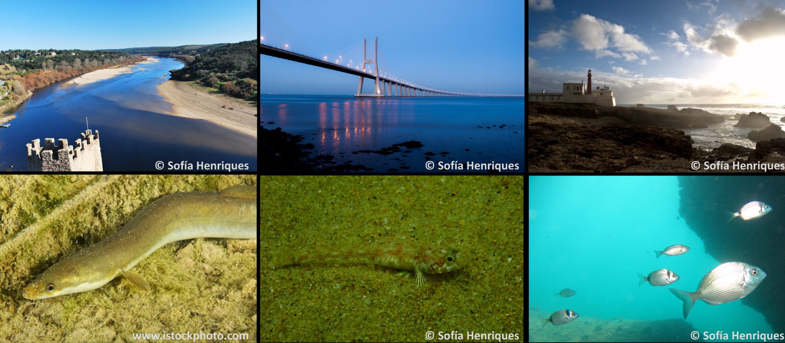
This study comprises the whole Tagus River basin, its estuary and nearby coastal waters. The Tagus River basin is the sixth largest in area in the European Atlantic coast (c. 80,000 km2, 1,000 km in length, 300 m3/s mean annual river flow), its estuary the largest in the Iberian Peninsula and one of the largest in Europe (320 km2, 40% of which is intertidal). The Tagus River encompasses important ecosystems important for migrating bird species, seasonal, and resident species. The aquatic fauna is extremely rich in fish, bivalves, polychaetes, invertebrates, phyto and zooplankton. Salt marshes along the shores are a clear example of the capacity of biological production, of carbon sequestration, as well as of trace metals. In 1980 the Tagus estuary was registered in the RAMSAR sites as being a wetland of international importance for birds.
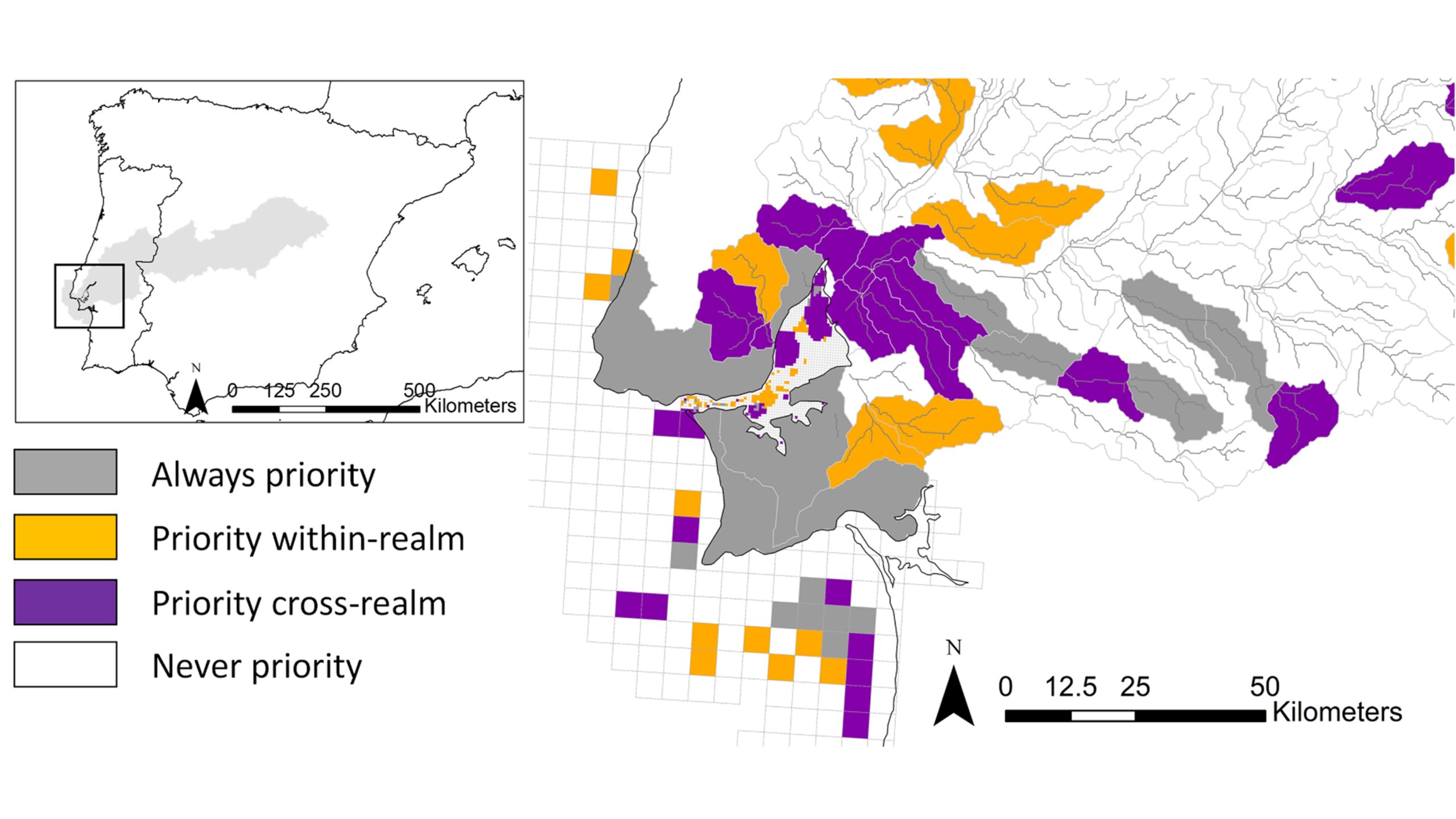
We defined three different types of planning units to match each realm's specific needs. For the freshwater–terrestrial realm, we used sub catchments sourced from Hydrosheds level 12. These sub catchments comprise a segment of a stream and the surrounding contributing land and have been used as planning units for freshwaters as they help address longitudinal connectivity along the river network, a key feature in the management of freshwater ecosystems and biodiversity. Sub catchments have also been used in terrestrial applications and in the integration of freshwater and terrestrial realms in conservation planning.
Sub catchments covered 130 km2 on average (ranging between 0.1 and 451.5 km2). Planning units for the estuary and marine sections were defined as grids of two different resolutions: 1 km2 for the estuary and 100 km2 for marine. Finer resolution planning units were used in the estuary given its smaller extent compared to the other two realms, and our interest in fine changes in bathymetry that drives connectivity in this realm.
Connectivity
Connectivity plays a key role in biodiversity conservation as it sustains ecological processes, such as migrations, important for the maintenance of populations. Connectivity is especially relevant for species that rely on different realms during their life cycle or use different realms daily or seasonally (multi-realm species). However, efforts to address conservation across multiple realms have focused on identifying priority areas for conservation in a single realm (mostly marine) while accounting for threats propagating from other realms or single species needs.
In this study we demonstrated how to identify priority areas for conservation across three different realms (freshwater–terrestrial, estuary and marine) for multiple species, including some multi-realm species, that inhabit or move across the three realms, using the Tagus River (Western Iberian Peninsula), its estuary and nearby marine area as a case study. We integrated multiple types of connectivity in the selection of priority areas for conservation, each of them customised to depict important drivers of movement within each realm and across realms: longitudinal connectivity along rivers or multidimensional connectivity in the estuary and marine realms, guided by currents and depth similarity, respectively. We compared the allocation of priority areas and spatial connectivity achieved under three scenarios: no-connectivity, within-realm and cross-realm connectivity scenarios.
Results
There were differences in the spatial allocation of priority areas across scenarios. The most remarkable difference laid on the connectivity achieved under each scenario, which experienced a threefold increase when considering connectivity across realms, compared to solutions that considered only connectivity within each realm independently. This improvement in connectivity was especially marked for species that occur across different realms. There were, however, trade-offs between this improvement in connectivity and the increase in the number of planning units selected, especially in the estuary. Addressing connectivity across realms deserves special attention when planning for the conservation of multi-realm species to ensure the adequacy of conservation recommendations to respond to the needs of multi-realm species. Given the potential trade-offs between enhanced cross-realm connectivity and total area needed or internal within-realm connectivity, consideration of cross-realm connectivity must be cautiously evaluated and integrated in multi-realm conservation plans.

Spatial distribution of best solution and selection frequency under two alternative planning scenarios tested in this study: within-realm and across-realm. Selected planning units in the best solution are in grey, and the selection frequency shown in different greys (higher frequency depicted by darker colours). A zoom into the estuary and surrounding area is showed for the sake of clarity.
References:
References
Hermoso, Virgilio, et al. "Conservation planning across realms: Enhancing connectivity for multi‐realm species." Journal of Applied Ecology (2020).
Contact Information:

Virgilio Hermoso
Centre de Ciència i Tecnologia Forestal de Catalunya (CTFC), Lleida, Spain


