Coastal Douglas-Fir Biogeoclimatic Zone
The Coastal Douglas-fir biogeoclimatic zone (CDF zone) is the smallest and most at-risk zone in British Columbia (B.C.). It is home to the highest number of species and ecosystems at risk in B.C., many of which are ranked globally as imperiled or critically imperiled, it is of great conservation concern. Of all the zones in the province, the CDF has been most altered by human activities. Less than 1% of the CDF remains in old growth forests and 49% of the land base has been permanently converted by human activities. The trend of deforestation and urbanization continues and has resulted in a natural area that is highly fragmented with continuing threats to remaining natural systems. Approximately 9% of the CDF zone is currently protected in conservation areas. The extent of disturbance, combined with the low level of protection, places the ecological integrity of the CDF zone at high risk. The Coastal Douglas-fir Conservation Partnership (CDFCP) is a collaboration of agencies, organizations and land managers who are interested in promoting and protecting healthy Coastal Douglas-fir and associated ecosystems into the future. Land trusts, governments (federal, provincial, regional, municipal, and First Nations), environmental stewardship groups, resource industry professionals, private landowners and academic institutions are encouraged to become CDFCP Participants or Supporters. The CDFCP’s mission is: To promote the conservation and stewardship of the Coastal Douglas-fir and associated ecosystems in south-western British Columbia through sound science, shared information, supportive policies, and community education.
The objective of this project was to create a conservation prioritization tool for the Coastal Douglas-Fir & Associated Ecosystem Conservation Partnership to be used in stakeholder meetings, inform planning in the CDF and allow CDFCP members to explore Marxan analysis interactively. The tool is a web-based, graphical user interface that follows the same principles as Marxan planning software to find near-optimal solutions to problems in conservation prioritization. Prior versions of this tool were designed for a much more restricted planning area in British Columbia, of interest to the CDFCP area, using “simulated annealing” as the solution algorithm. In contrast, the current tool uses “integer linear programming” (ILP) to return a single optimal solution over ~3 million parcels. ILP represents the state-of-the-art approach to optimization problems, being faster and more efficient than simulated annealing, but only recently becoming available with the advent of fast computer algorithms. The ILP algorithm employed here is capable of analyzing large, complex datasets to find an optimal solution to user-defined biodiversity goals, subject to user-defined costs, both explained in detail below.
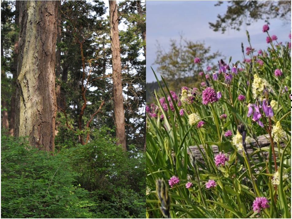 Coastal Douglas-fir ecosystem forest (left) and meadow (right).
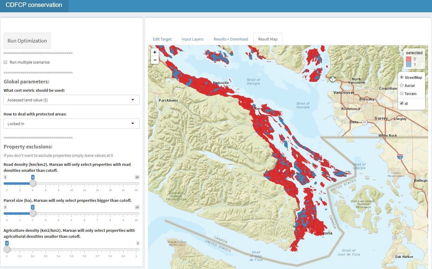 Browser user interface to Marxan with use for scenario generation: https://forbasin.forestry.ubc.ca/CDFCP_prioritization/
 Partners
Notably, this project brought together many partners including the Coastal Douglas-Fir & Associated Ecosystem Conservation Partnership (CDFCP), the University of British Columbia, the Nature Trust of British Columbia, the British Columbia Ministry of Environment, the British Columbia Ministry of Forests, Lands and Natural Resource Operations, the Nature Conservancy Canada, Parks Canada, the Environment and Climate Change Canada, the Cowichan Valley Regional District, the Island Trust, and the Habitat Acquisition Trust. The work and collaboration of these groups was an important factor in the uptake of the tool and it's outputs.
Results
This project has been used to inform the Coastal Douglas-Fir and Associated Ecosystems partnership conservation strategy. The strategy provides sound science to support land securement and stewardship, which uses Marxan to develop landscape-level maps that identify potential conservation priorities. Through this project partners were able to refine landscape-level mapping by improving data collection quality and input tools, identify high-value conservation areas for discussion with partners, identify CDFAE values within existing protected areas and determine the amount and spatial distribution of ‘additional’ protected areas required to create a resilient system, create realistic scenarios for ‘core’ protection, taking into account spatial distribution and connectivity, identify working landscapes and other lands with high CDF values, develop and keep current a list of priority parcels for securement, develop information on those parcels to support acquisition, and develop a methodology for ranking and ground truthing an individual conservation opportunity.
The project has also been used to explore a property tax mechanism to finance conservation easements or related contracts as a partial‐property acquisition strategy to meet Convention on Biological Diversity (CBD) treaty targets to conserve critically imperiled coastal Douglas fir ecosystems in Canada. Additionally, it was also used to ask how the sale of forest carbon offsets could reduce land acquisition costs, and how the alternate goals of maximizing α or β-diversity in focal communities could affect the prioritization land parcels over a range of conservation targets.

Example feature layers for the Coastal Douglas Fir region. Old forest community map (left) and beta diversity map (right).
References:
References
Coastal Douglas-Fir and Associated Ecosystems Conservation Partnership (2015) Conservation Strategy. http://www.cdfcp.ca/attachments/CDFCP_CS_2015.pdf
Schuster, Richard, et al. "Tax shifting and incentives for biodiversity conservation on private lands." Conservation Letters 11.2 (2018): e12377. https://doi.org/10.1111/conl.12377
Schuster, Richard, Tara G. Martin, and Peter Arcese. "Bird community conservation and carbon offsets in Western North America." PloS one 9.6 (2014): e99292. https://doi.org/10.1371/journal.pone.0099292
Contact Information:

Peter Arcese