Conservation in the Coral Triangle
Background
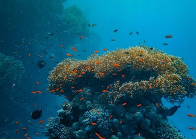
Coral reef ecosystems are sentinels for human-induced change, but they also support the livelihoods of almost 1 billion people. The global centre of marine biodiversity is called the Coral Triangle – an area containing the marine jurisdictions of Malaysia, the Philippines, Indonesia, Timor Leste, Papua New Guinea, and the Solomon Islands.
As part of the Coral Triangle Initiative for Coral Reefs, Fisheries, and Food Security, Marxan was used to identify conservation priority areas to meet the Initiative’s goals for establishing and expanding effective marine protected areas, protecting threatened species, enhancing coral reef fisheries, and adapting to climate change.
Planning Objectives
We created six conservation objectives to capture these goals:
 Habitat Representation: We captured 9 habitat features of nearshore marine areas including coral reefs, mangroves and seagrass with 20% targets, and 21 unique bioregions.
 Fish Spawning Aggregations: We collaborated with SCRFA to obtain current records for fish spawning aggregation sites. Planning units with these sites were locked in to ensure their protection. Because fish travel to aggregations sites ranging from 10-100km, we set a 20% target for each 30km catchment area of known spawning aggregation sites.
 Threatened Species: Sea turtles’ life cycles encompass nesting beaches, migration pathways, breeding and feeding sites. Often they migrate far; our top migrating turtle travelled from its foraging site in Malaysia to its nesting site in Papua New Guinea. We collaborated with WWF Indonesia to obtain migration tracks for four species of telemetry tracked turtles. We set 30% targets for a 30km area around nesting and foraging sites, and we maximised migration connectivity using Marxan with Connectivity. This was the first study to integrate migration connectivity into a Marxan analysis.
Fish larval connectivity. With a biophysical models to represent larval movement, we maximised dispersal connectivity using Marxan with Connectivity. We examined planning scenarios for two important fishery species:
- Coral Trout. This fish from the grouper family (Serranidae) is a good disperser, with a 30 day pelagic larval duration.
- Sea cucumber. This echinoderm (Holothuridae) is a very important cash fishery in the region when there is no refrigeration available on fishing boats because the catch can be dried. Sea cucumbers do not disperse well, with a short 10 day pelagic larval duration.
 Climate change. With a coral health model for two typical life histories of corals and thermal regime projections up to 2100, we determined the likely degradation rates of reefs across the region. We then reduced the known reef area in each planning unit according to these rates and identified priority areas for the original 20% habitat representation. This was the first study to integrate projected future decline rates of coral reefs into a Marxan analysis.

Results
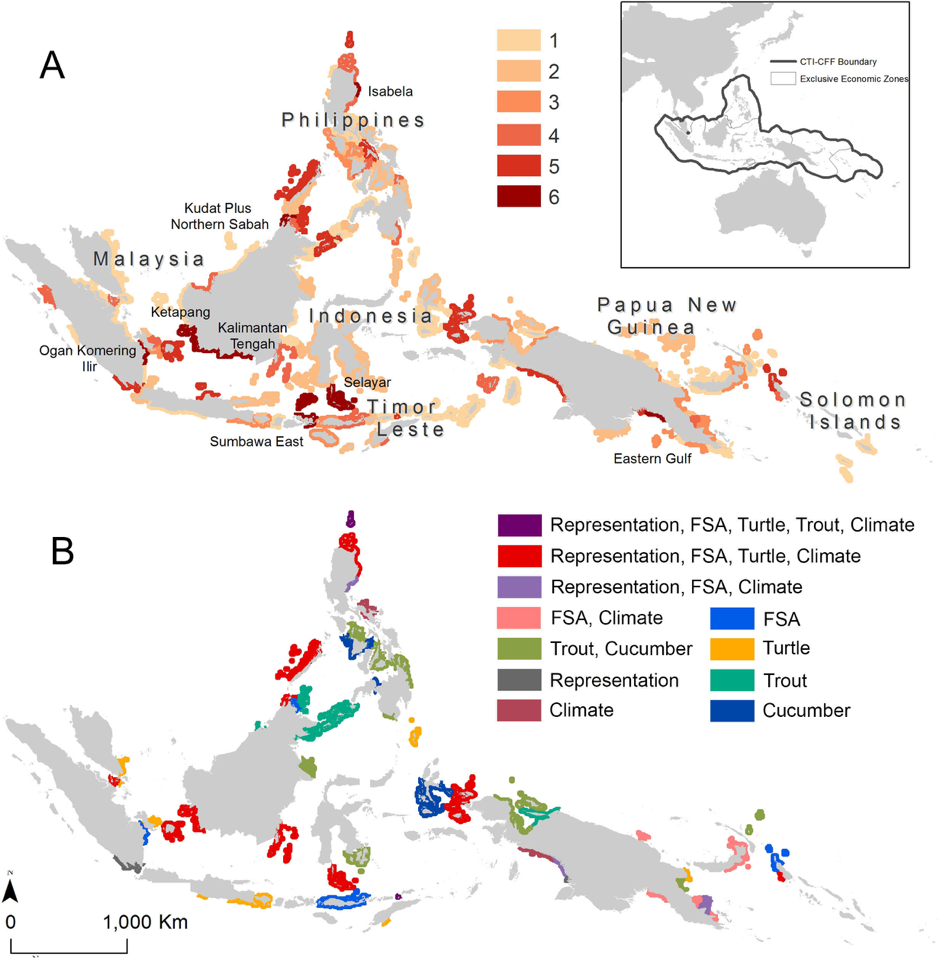
We found that the priority areas differed across planning scenarios. We developed two methods to integrate priorities across the six objectives. Areas that provide high conservation benefits (75 percentile) for multiple objectives were identified and mapped at the province level. There are eight provinces that achieve high benefits across all six objectives (Multi-objective Hotspots- map A).
However, there are also provinces where very high (90 percentile) conservation benefits can be achieved for one or several objectives. For example, some provinces can contribute the highest possible benefit for the connectivity objectives, but are not priorities for climate change adaptation. However, these areas are still very important for achieving relevant Coral Triangle goals, and sometimes it is more appropriate for a province, country, or species to work on specific conservation actions related to only a single objective. We highlighted these areas as Complementary Priority Areas, because by working together on conservation efforts in these areas, the Coral Triangle nations can maximise the joint benefit across all six objectives < complementary map, B>. It also means that each nation can chose how to incorporate regional priorities into their national planning.
References:
Contact Information:


